Trail Stats/Info:
Location: Fort Collins, Colorado
Length: No set length, ranges anywhere from 3-7 miles RT.
Elevation gain: ~500 feet
No entrance/parking fee
Dogs must be leashed
Trail map
I’ve recently started hiking the area known as Reservoir Ridge in Fort Collins, and I think it’s becoming my favorite go-to. It’s an area that you essentially create-your-own-loop, so you can hike anywhere ranging from 3-7 miles round trip. Plus, the elevation gain is mild and well distributed throughout the switchbacks, so it’s a very pleasant trail overall.
Something else that’s great about it – Free parking!
A friend of mine and I took our dogs there a few weeks ago, and I went back on a nice day with just Joule. Although the weather turned sour real quick for us then. On the first hike, we did probably around 5 miles. For the second time, I took an extra loop that gave us an addition 1 mile on the hike. Plus with the storm coming in, we fast walked/jogged for part of it.
The trailhead/parking lot is actually less than a 5 minute drive from my house, so you can see why I enjoy going there a lot now.
Plus, I like the idea of walking up to the foothills. The first 1.5 miles of the trail from the parking lot is flat walking up to the base of the first ridge (hence the name, Reservoir Ridge) of the foothills.


The last photo was taken on our route back, hence no foothills in the distance.
Once you reach the foothills, you take a series of winding routes and switchbacks up the hillside. I just love it.

I don’t hike the plains area a lot because frankly, I think it’s boring. But there’s something about this area that just gets me. There’s a beauty to the prairie grass covered hills.
I’m sure it’ll be just gorgeous in the summer time too.
When hiking, you’ll hit a few trail splits. The first one is the starting/ending point of the northern loop. Personally, I say keep left/south and hike the loop from that direction.
The second split you’ll hit will be the foothills trail split. This later gives you the option to continue the loop back to the trail you were on, or continue down the foothills trail way south. The first time I did this hike, I opted out of that loop and continued right on the trail. The second time, I took that loop, then came around and continued on the northern loop as well.
Since that description is obviously confusing, here’s two maps showing my loop routes.


You do have the option to only do the southern loop and connect back to the main trail. I just chose to continue onto the northern loop.
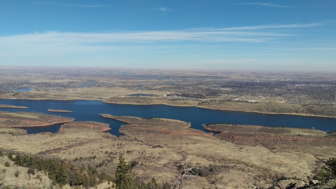
The south loop goes through this lovely area, then comes out with an overview of Horsetooth. We crossed the road at this point for some photo ops. Maybe not the best idea when the wind was pushing 50mph!

Windy ear malfunctions are the worst.
We continued onto the northern loop, which, the walk along the ridge here is beautiful.

Someone wasn’t a fan of the wind.
There’s lovely places to sit down on the northern loop.
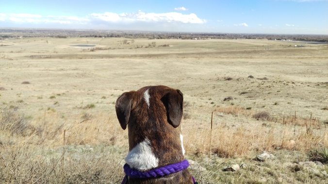
During our first hike here, Cali and Joule took the time to take in the scenery.

The second time…we had nasty storm clouds rolling in and that was our cue to book it down the mountain.

If you aren’t having to book it on the route down from the ridge, there’s some nice rock areas just off the trail.

Connect back with the main trail, and start your cool-down hike back to the parking lot.
Overall, it’s a really delightful trail. If you’re looking for a quick 1.5-2 hour hike, I highly recommend it.


