Reservoir Ridge


Trail Stats/Info:
Location: Fort Collins, Colorado
Length: No set length, ranges anywhere from 3-7 miles RT.
Elevation gain: ~500 feet
No entrance/parking fee
Dogs must be leashed
Trail map

I’ve recently started hiking the area known as Reservoir Ridge in Fort Collins, and I think it’s becoming my favorite go-to. It’s an area that you essentially create-your-own-loop, so you can hike anywhere ranging from 3-7 miles round trip. Plus, the elevation gain is mild and well distributed throughout the switchbacks, so it’s a very pleasant trail overall.

Something else that’s great about it – Free parking!

A friend of mine and I took our dogs there a few weeks ago, and I went back on a nice day with just Joule. Although the weather turned sour real quick for us then. On the first hike, we did probably around 5 miles. For the second time, I took an extra loop that gave us an addition 1 mile on the hike. Plus with the storm coming in, we fast walked/jogged for part of it.

The trailhead/parking lot is actually less than a 5 minute drive from my house, so you can see why I enjoy going there a lot now.

Plus, I like the idea of walking up to the foothills. The first 1.5 miles of the trail from the parking lot is flat walking up to the base of the first ridge (hence the name, Reservoir Ridge) of the foothills.

OLYMPUS DIGITAL CAMERA

OLYMPUS DIGITAL CAMERA

The last photo was taken on our route back, hence no foothills in the distance.

Once you reach the foothills, you take a series of winding routes and switchbacks up the hillside. I just love it.

OLYMPUS DIGITAL CAMERA

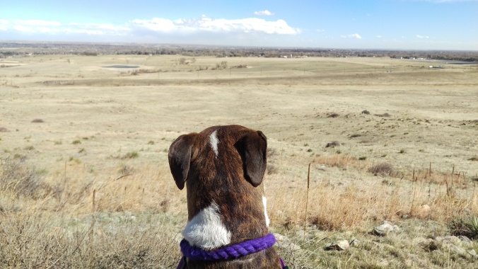
I don’t hike the plains area a lot because frankly, I think it’s boring. But there’s something about this area that just gets me. There’s a beauty to the prairie grass covered hills.

I’m sure it’ll be just gorgeous in the summer time too.

When hiking, you’ll hit a few trail splits. The first one is the starting/ending point of the northern loop. Personally, I say keep left/south and hike the loop from that direction.

The second split you’ll hit will be the foothills trail split. This later gives you the option to continue the loop back to the trail you were on, or continue down the foothills trail way south. The first time I did this hike, I opted out of that loop and continued right on the trail. The second time, I took that loop, then came around and continued on the northern loop as well.

Since that description is obviously confusing, here’s two maps showing my loop routes.

res ridge 1res ridge 2

You do have the option to only do the southern loop and connect back to the main trail. I just chose to continue onto the northern loop.

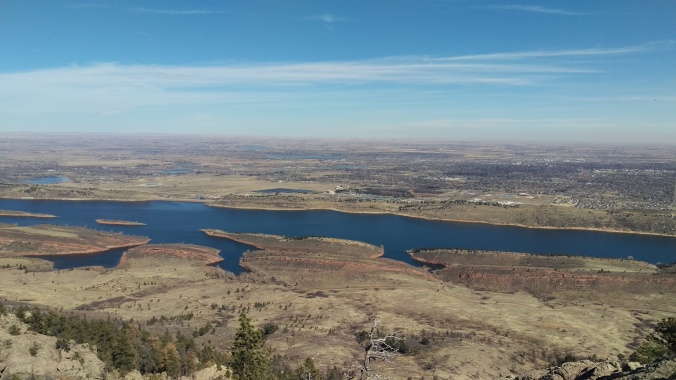
The south loop goes through this lovely area, then comes out with an overview of Horsetooth. We crossed the road at this point for some photo ops. Maybe not the best idea when the wind was pushing 50mph!

2016-03-14 13.45.44

Windy ear malfunctions are the worst.

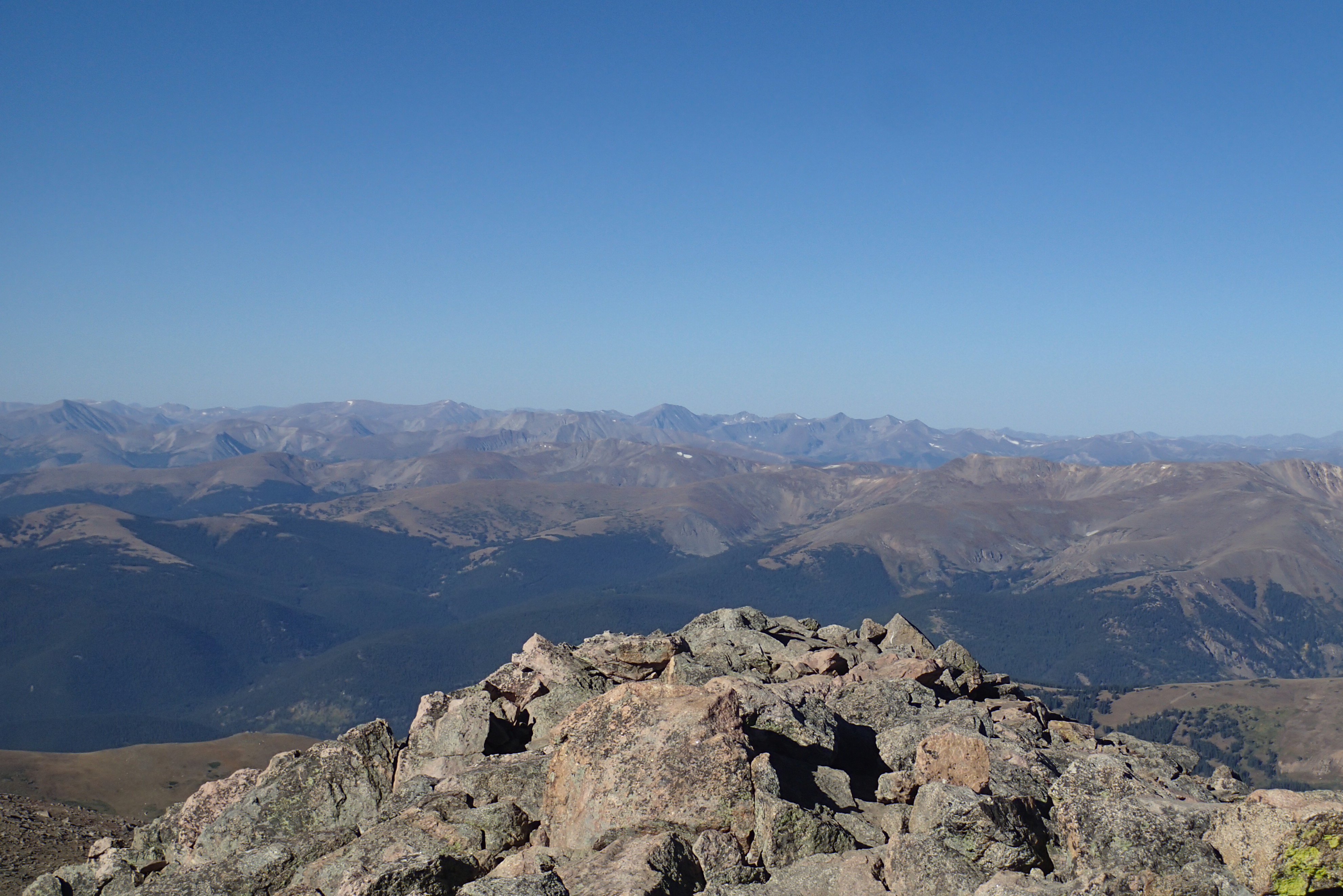
We continued onto the northern loop, which, the walk along the ridge here is beautiful.

OLYMPUS DIGITAL CAMERA

Someone wasn’t a fan of the wind.

There’s lovely places to sit down on the northern loop.

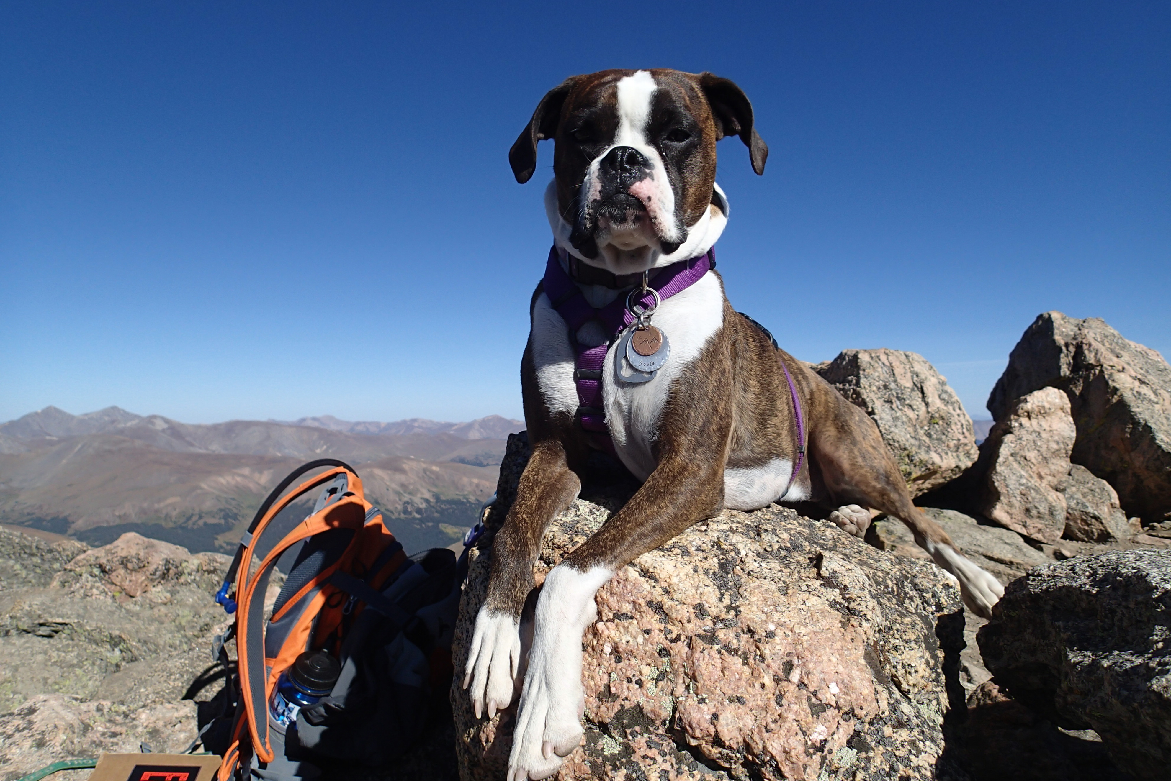
During our first hike here, Cali and Joule took the time to take in the scenery.

2016-02-27 13.13.46

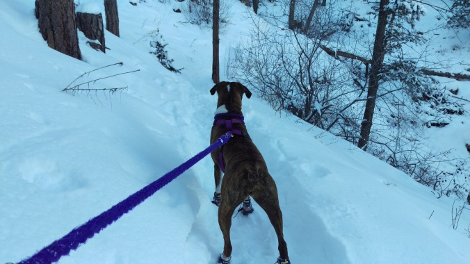
The second time…we had nasty storm clouds rolling in and that was our cue to book it down the mountain.

2016-03-14 14.09.49

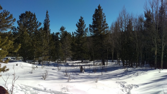
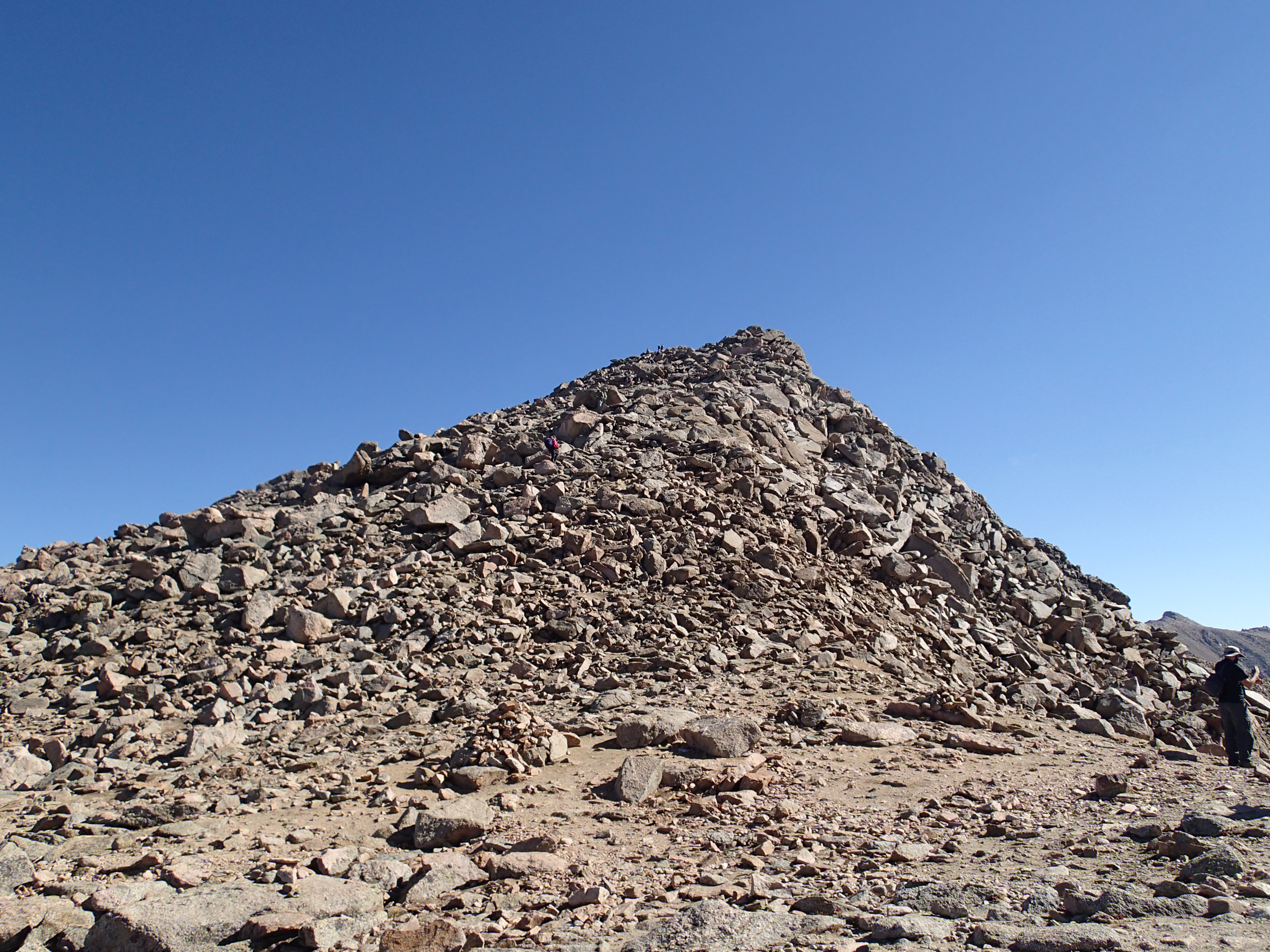
If you aren’t having to book it on the route down from the ridge, there’s some nice rock areas just off the trail.

2016-02-27 13.45.04-2

Connect back with the main trail, and start your cool-down hike back to the parking lot.

Overall, it’s a really delightful trail. If you’re looking for a quick 1.5-2 hour hike, I highly recommend it.

2016-03-14 14.36.26


Arthur’s Rock

Trail Stats/Info:
Location: Lory State Park, Fort Collins, CO
Length: 3.4 miles round trip
Elevation gain: 1,200 feet
Park entrance fee $7
Dogs must be leashed.
Trail map

Arthur’s Rock is one of the classic Fort Collins hikes, in addition to Horsetooth Rock.

Last time I attempted Arthur’s Rock was over 2 years ago with my cousin, and my dog ended up having a heat stroke. It was scary, and I think that made me nervous to hike in Lory State Park during warmer days for quite a while.

Well, when it was destined to be 75 degrees on a Friday in March, I couldn’t resist attempting it again. The thing that makes this hike very hot is that it’s very exposed for a good portion of the trail. Even when starting the trail when it was probably around 60-65 degrees out and having plenty of water, Joule was still heating up a bit. I made sure to take quite a few breaks.

I used this hike as a test run for how my joints handle decent elevation gain. At a 1.2k feet gain over ~1.5 miles, Arthur’s Rock definitely as a hefty incline at some portions. But, the trail also handles it quite well so it’s not as noticeable for the most part. Overall, great practice trail for these ol’ joints of mine!

The hike starts up some switch backs to get you up the initial hill, then you’re greeted by a walk across a grassy clearing with the great view of Arthur’s Rock, plus the climb ahead.

2016-03-11 12.22.28

After crossing the clearing, you begin the final switch backs that take you to the eastern base of Arthur’s Rock

The views on this part of the hike are pretty great.

2016-03-11 12.39.532016-03-11 14.34.352016-03-11 12.43.38

When you reach the South-Eastern side of Arthur’s Rock, there’s a nice overlook area with some rocks to scramble.

2016-03-11 12.55.23

But don’t stop there! The trail will take you along the edge of Arthur’s Rock, leading you up to the western side. There’s a bit more shade in this area, so it’s a good place for a quick break if you need it.

The trail will take you right up to the rock, where now it’s time to walk from rock to rock/scramble up the final ascent area.

2016-03-11 13.19.40

Once you get to the top, the views are breathtaking.

You have Horsetooth Reservoir before you, then the rolling pine-covered foothills and a peak at some of the Rocky Mountain peaks behind you.

2016-03-11 13.26.27

2016-03-11 13.36.10

Take your time up top. It’s a great place to relax, take some pictures, drink some water (or beer, shame I forgot mine!). Or you can just lie on the cold rocks for a bit.

A fun thing to do after the descent is cool off in one of the coves of Horsetooth. My particular favorite (because technically the hike down to it takes you out of Lory State Park) is the one near Eltuck picnic area. It wasn’t warm enough out for me to want to take a swim. But Joule sure enjoyed it.

2016-03-11 15.15.54

Definitely going to be doing this hike again during another spring day. Maybe even a sunrise hike?

Opinion time – Would you like the trail stats at the beginning, end, or in the middle-ish (right after my intro but before I begin discussing the trail itself)?

Joule’s Birthday!

2016-01-10 13.37.51


Joule’s birthday was January 10th, and birthday #5 seems like a big birthday. Heck, they all seem like big birthdays. We’ve never really done anything super special beyond getting some extra food, a new toy, etc. In fact, one year she even spent her birthday drugged up since she had just been diagnosed with pancreatitis and was trying to battle that. That birthday was crummy for her.

This year I started to think – What would make for the best dog day ever?

2016-01-10 13.18.45


The day started off with a delicious breakfast of kibble topped with 2 over easy eggs. I’ve given her scrambled eggs before, but she went crazy over the liquid yolk.

Then we started to prep for a fun afternoon of snowshoeing! We went up to Lory State Park and created our own loop that ended up being around 4.5-5 miles total after I tallied it up.

2016-01-10 12.37.38

We parked at the Arthur’s Rock trailhead area, hiked up that trail to the first fork. That’s where we opted for the Overlook Trail. This might actually by my favorite trail in the Park area now. The views were just so gorgeous!

2016-01-10 12.31.31

From start to finish (which comes out at the Homestead Picnic Area), that trail is about 2 miles with ~500 foot elevation gain. Most of that gain is right at the beginning of the trail, then you’re walking along the hillside with amazing views of Horsetooth Reservoir.

2016-01-10 13.21.31

2016-01-10 13.59.44


We even saw some deer. Joule was pretty stoked about that and spent about ten minutes talking to them.

2016-01-10 13.52.43

Once we reached the Homestead Picnic Area, we hiked up the road to Eltuck Picnic Area. We hiked East from there to reach the midpoint to the East Valley Trail. We took that South and it’s a fairly easy, pleasant snowshoeing trail. This was where we had some snow where Joule’s paws kept going through, while my snowshoes helped me out.

The elevation gain wasn’t bad for this trail – maybe around 300 feet? But by the end, it felt like a lot. We’re still new to snowshoeing so we get exhausted quickly!

2016-01-10 12.33.55

We took that trail all the way back to the Arthur’s Rock trailhead, thus completing our little loop.

Joule was asleep in the truck before we even left the parking lot.

2016-01-10 15.55.15

When we arrived back home, Joule passed out for a nap while I began making her some delicious pupcakes. She helped with taste testing and fully approved.

2016-01-10 16.55.36-1

After quickly decorating a few, we took them to her brew dog friends at Snowbank Brew. Of course, I had to enjoy a quick pint while she napped on the floor (I’m sensing a napping theme here?).

Dinner for her was kibble mixed with pumpkin puree, topped with another over easy egg. She spent a solid 15 minutes licking her bowl after she finished because she had to make sure to get every little bit.

Before pupcake time, she enjoyed playing with 2 new toys (the frisbee is in safe keeping now until we have time to take it outside).

2016-01-10 19.18.53

And of course, the grand finale – Her own pupcake! I put a little extra decoration on it and she just went nuts over it. I tried one myself and when I was sitting there eating it, she was in my face, begging for more. Of course I shared. Duh. It’s her birthday.

The remaining few hours of the night was spent cuddling on the couch, with her drooling on me and snoring.

2016-01-10 20.44.21

She was still pooped the next day and it made me smile. Because I know I gave that dog one hell of a day.

OLYMPUS DIGITAL CAMERA

OLYMPUS DIGITAL CAMERA

Birthday Snowshoe Adventure

OLYMPUS DIGITAL CAMERA

It’s been a while since I’ve gone snowshoeing. And when I say that, I don’t just mean a couple years. It’s been over 10 years since I went snowshoeing, and honestly, I barely remember the original hike. That was my first and only snowshoeing trip until the first of this year.

Being a New Year’s baby is always weird and kind of disappointing because no one is ever really free to do anything. I remember it being difficult to throw a party when I was younger, then I turned 21 and no one was in town (since I live in a college town and everyone would go home for the holidays. So I started going to Keystone – rented a condo, invited friends or my current SO to come hang up there and snowboard alongside me. I did that for 2 years and absolutely loved it. I said okay, this is how I want to continue to spend New Year’s Eve/Day/My birthday.

Then this year happened and I was too broke to afford a condo and snowboarding. That’s when the idea came up – all I wanted to do for my birthday was go hang out in the woods alone.

After countless hours of searching for an easy snowshoe trail that was easily accessible (all the roads to the trailheads are closed for the winter!), I finally settled on trekking a few miles north on the Sourdough trail from the Brainard Lake Recreation area.

Well of course, thanks to a few cocktails to celebrate ringing in the new year, I didn’t wake up quite as early as I planned. Whatever, it was worth it. I rang in the new year with a pint of porter and wearing my dog’s face on my shirt. I can’t really complain.

I didn’t actually reach the trailhead until about 10:30am, when the original plan was to be there around 9am. Oops.

If you’ve never been up to the Brainard Lake area – I highly recommend it. I’ve gone there both in the summer and winter, and both times it just blows me away. I hiked to Isabelle Glacier twice over the summer, and now I may try to make it to at least Lake Isabelle this winter. Below, there’s a photo from Lake Isabelle in the summer (left), the from the winter parking lot a few days ago (right). Mind blowingly gorgeous, right?

We didn’t snowshoe very far, I think about 1.65 miles in, then back. Once I hit the first Wapiti trail loop split, I continued on a little bit so I could go into a clearing and enjoy myself. Why didn’t I go further? Because elevation starts to drop faster, and that uphill climb back (while only ~500 feet elevation gain) was going to be rough for someone who’s still new to snowshoeing. I was right, it sucked. If I could just never snowshoe uphill, that’d be fantastic.

But you know what? Who cares. It was my birthday, and if I only wanted to snowshoe ~3.5 miles, then that’s my own choice. I wasn’t going for distance or pushing myself – I wanted to wander alone (besides the few people I ran into on the trail) in the woods with my dog, surrounded by snow. I never understand why people make fun of others for doing short hikes. If you want to do a short hike to just take in the scenery, by all means, do it!


And honestly, it was the best birthday I’ve had.

2016-01-01 11.27.46

First off, it was the most perfect, beautiful Colorado day for any outdoor adventure. There wasn’t a cloud in the sky, and I don’t think the temperature ever reach 20 F. Now, that sounds cold, but anyone who has hiked in the winter can tell you that the lower temps feel pretty good when you’re working up a sweat.

It started off with Joule not liking my snowshoes and poles, so she kept trying to fight me.

I kept trying to make her walk behind me, because otherwise she walked way too far ahead of me since she didn’t want to be near the shows/poles. What a goober. But when she walked behind me, she kept stepping on my snowshoes! So at one point, she bolted past me (because obviously the snowshoes were going to attack), tried bounding through a snowbank just to the side of the trail and ended up tripping and faceplanting into the snow. I laughed so hard that I really thought I was going to pee myself.

We kept hiking until I decided I wanted to just sit down in a clearing, soak up the sun and enjoy a beer while Joule explored around me.

2016-01-01 13.06.09

It was relaxing, it was gorgeous out, and I had a beer in my hand.

Seriously, happy birthday to me on that one.

2016-01-01 12.48.30

Next time I’d like to take the Wapiti trail around, although I’m having difficulties finding the length/elevation gain on that trail. Since I’m still so new to snowshoeing, it’s a real concern for me.

I topped off my birthday with some cocktails with a close friend, then went home and cuddled the dog.

Best birthday ever, by far.


Mount Bierstadt – My First 14er

OLYMPUS DIGITAL CAMERA

So on Friday I hiked/scrambled my first 14er. I was pretty excited about it, even when my alarm went off at 3:30AM after I had gone to bed two hours previously….after some drinking in Denver with the Gociety crew. Needless to say, I had to pop a few Aleve before starting the drive to the trailhead.

The 14er we chose was Mt. Bierstadt, which is actually known to be one of the easier 14ers and is recommended to beginnings. If that beast is an easy 14er, I can’t imagine what others are like.

To put it simply – It kicked my ass.

But Joule was a champ. She was bouncing all around that mountain like it was a normal everyday walk.

We started around 6am, with the world around us still pretty dark. That’s my favorite though. If you’ve never done any night hiking, definitely try it. There were some coyotes howling in the distance which added to the whole “let’s go climb a mountain in the dark” scenario.

Probably 1.5-2 miles into our hike, the sun was finally starting to peak over the mountains and shine onto the tips of the opposite peaks.

Cue “Circle of Life” song intro for Lion King.

OLYMPUS DIGITAL CAMERA

This was before hell happened, before shit hit the fan, before I regretted what I had agreed to do.

The remaining mile and a half was terrible. It was probably one of the worst sections of a hike that I have ever done. We were stopping like every 5 minutes to take a break, catch our breath, and let our muscles come back to life. It was that nuts.

At first I felt bad for all the stopping, but then all of us admitted that it was needed.

Once we made it to the saddle just below the summit, I was feeling good. I’m not the greatest at steep climbing, but I can scramble really well.

OLYMPUS DIGITAL CAMERA

It took us roughly 3 hours total to summit Bierstadt, which I can’t tell if that’s good or bad.

The view was pretty spectacular though.

OLYMPUS DIGITAL CAMERA

Although, I’m not sure how worth it it really was. If I climb/hike something crazy, I want something to do at the top. I’m a big fan of alpine lake hikes for this reason. Because at least I have a cool lake to hang out at.

This was just like “Oh, I did this difficult hike only so I could say I’ve been to a mountain whose peak is above 14,000 ft? That’s it?”

We hung out up top for a while, drinking some brews for #EarnYourBeer and taking awesome Gociety photos.

OLYMPUS DIGITAL CAMERA

OLYMPUS DIGITAL CAMERA

What cracks me up about Joule is that it doesn’t matter where we are – once we summit, she wants to lay down and enjoy the view.

OLYMPUS DIGITAL CAMERA

Queen Joule Bug, Summit Master, Eater of Wild Thing’s Poop.

Majestic af.

I tried to take some selfies with Joule but she’s kind of difficult.

2015-09-11 09.17.252015-09-11 08.52.17

The descent didn’t take us nearly as long. Probably around an hour and a half total.

The views were absolutely gorgeous. Compared to the ascent when most of the mountains and the valley were still hidden in the shadows, we finally had the sun shining over everything.

OLYMPUS DIGITAL CAMERA

For the entire hike, whenever we had to stop, Joule wasn’t very happy with it. For the ascent, she’d stand there crying because she wanted to keep going. On the descent, she just walked off without us.

OLYMPUS DIGITAL CAMERA

That was when I stopped to get my camera out for a photo. Apparently that took too long so she nope’d right out of there.

OLYMPUS DIGITAL CAMERA

She was a total goober for part of the hike too. Big fan of rolling around in the grass and getting extra dirty.

In fact, towards the end of the hike (this was when all of us were just wanting to get back to the cars so badly), she got the zoomies. For those non-dog owners out there, the zoomies consist of running around at top speed like a mad dog.

Well she got those, and then during the zoomies would dive bomb head first into the ground and flip/roll around in the grass.

I was giggling like an idiot while watching it.

Overall, the hike was fun. Sure, it’s cool to say that Bug and I summitted our first 14er together, but beyond that, I don’t think I’m going to directly try to summit another anytime soon. Now, if a friend wants me to join, I could probably be convinced.

But beyond that, I’m happy to stick to my other non-14er hikes.

OLYMPUS DIGITAL CAMERA

Labor Day Shenanigans

OLYMPUS DIGITAL CAMERA

I think the whole idea behind Labor Day is to relax because it’s a holiday, but that sounds boring so of course I went on a hike. What a gorgeous day for it too.

A few Gociety friends and I decided to trek up Grey Rock since well, that’s a classic Fort Collins hike.

It’s about 8 miles round trip, with roughly 2,000 feet elevation gain. But boy, is it worth it. My quads and knees are definitely aching a little bit today though.

We took the longer side of the loop (Meadows Loop) up, mainly because the view is spectacular. We started early, so the sun didn’t rise until maybe a mile or two into the hike.

You basically hike up the side of the mountain and come over the top and can just see mountains for miles.

Heaven.

You come over the final little hill, and that’s when you see it – Grey Rock in all of its majestic glory.

And a cute little Boxer.

2015-09-07 07.42.39

From there, you hike down into a meadow valley. It’s a really lovely part of the hike. It’s basically downhill/flat for probably a mile, which is a relief to the muscles that hauled you up the first hill. Plus, it was an open space for the dogs to run around and they obviously didn’t enjoy that at all.

2015-09-07 07.52.56-1

You hike up to the base of Grey Rock and hang out, drink some water, maybe eat a snack real quick as you prepare for the scramble up.

OLYMPUS DIGITAL CAMERA

Joule and Mayson make funny faces.

You start the scramble up and you don’t even realize how high up your climbing because you’re just so focused on the climbing. My knees started to ache a little bit during this, but not too bad. I was actually relieved at how well my back and knees handled it all.

OLYMPUS DIGITAL CAMERA

You reach the semi-top of Grey Rock, and there’s a full pond there! It’s one of the nice hidden treasures of this hike. We then climbed up the rocks you see behind me in the photo, and hung out at the summit for a while. But holy cow, it was pretty windy.

2015-09-07 08.57.06

The view made it worth it, don’t you think? I’m not sure which 14er can be seen in the background.

It was a bit too windy though so after snacking a bit, drinking some water, and snapping some mandatory selfies, we began the descent back down.

2015-09-07 09.02.18

Of course we had to stop so Joule and Mayson could run around in the water and begin to strengthen their hiking dog friendship bond they’ve been working at for a few weeks now.

OLYMPUS DIGITAL CAMERA

From there, it was just a descent hike. We took the shorter part of the loop back, which ended up being a good/bad choice. The good part was that we heard the meadows side of the loop was just absolutely packed with people who are slackers late starters.

The bad part? A nasty rattle snake was on the trail down. For anyone who hasn’t encountered one of these satanic creatures – they are not nice animals. They’re very venomous snakes that are awesomely camouflaged to blend into the tan landscape that’s associated with Rocky Mountain hikes. Nice of them, right? The reason they’re named rattle snakes is because they have a rattle on the end of their tail that they shake when they’re angry. If you look just above his head in the picture below, you’ll see it.

We were really lucky. A human, not a dog, was leading our hiking expedition on the way down. Joule was tight on my leash, and the other dog was behind me. When we heard it rattle, we quickly moved backwards and basically hung out for a bit trying to figure out what  to do.

Someone found a huge stick and picked the snake up before tossing it into the tall grass away from the trail.

OLYMPUS DIGITAL CAMERA

Overall, what an awesome trip. This was my first time hiking Grey Rock in two years, and it was nice to see that I’m in better hiking shape than I was last time. Joule and I are getting ready to climb our first 14er, Mt. Bierstadt, on Friday, so this was a solid way to prepare for that.